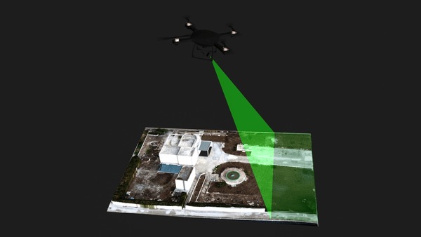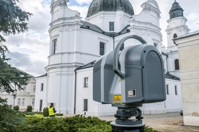

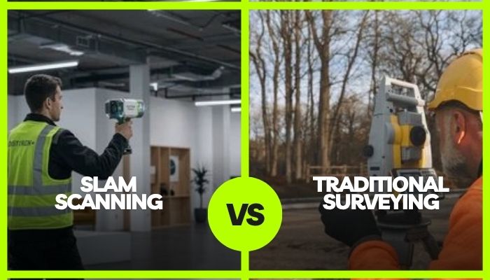
Simulating real-time 3D spatial mapping, Simultaneous Localisation and Mapping (SLAM) scanning rapidly captures complex spatial environments without static tripod setups. In contrast, traditional surveying utilises total stations for high-accuracy pinpoint boundary measurements, offering distinct operational advantages depending on project parameters.
Key Takeaways
- SLAM scanning accelerates data collection speed across complex indoor and subterranean construction sites significantly.
- Traditional surveying provides unmatched millimetre precision required for legal boundaries and structural foundations.
- Hybrid surveying approaches optimise overall project budgets while maintaining critical structural engineering standards.
Selecting the optimal spatial measurement technology directly influences construction timelines, budget allocations, and overall project safety standards. Modern site managers must balance rapid data capture against extreme measurement accuracy requirements.
Understanding key performance differences between mobile SLAM scanning and conventional surveying methods helps project teams choose the correct technology. This comprehensive guide evaluates both approaches to optimise your construction workflow.
Understanding SLAM Scanning Technology in Modern Construction
Many site owners do not know what is SLAM scanning.
SLAM (Simultaneous Localisation and Mapping) technology allows mobile hardware devices to map unfamiliar environments dynamically while simultaneously tracking device locations within that space. This continuous data capture mechanism revolutionises rapid spatial mapping across active builds.
Key Advantages of Mobile SLAM Scanning
Mobile LiDAR units capture millions of spatial points per minute while operators walk through project sites naturally. This rapid mobility slashes site measurement schedules dramatically compared to conventional tripod-mounted scanning systems.
Furthermore, mobile SLAM survey equipment excels inside complex enclosed spaces, subterranean tunnels, and heavily obstructed structures.
Limitations of SLAM Systems
While mobile SLAM scanning delivers exceptional data capture speed, field teams must understand the key technical constraints:
- Algorithmic Drift: Continuous movement without static reference points can cause minor inaccuracies over larger scan areas.
- Control Point Dependence: Very large site perimeters still require georeferenced control points established via traditional equipment to maintain long-range spatial consistency.
- Environmental Interference: Highly reflective surfaces or featureless environments (such as long, uniform corridors) can temporarily confuse trajectory calculations during SLAM surveying.
Traditional Surveying Techniques and Their Enduring Value
Traditional surveying relies on optical total stations, digital levels, and Global Navigation Satellite System (GNSS) receivers to establish definitive spatial reference grids. These time-tested methodologies remain essential across fundamental civil engineering and land development projects.
Unmatched Precision for Critical Engineering
Total stations deliver sub-millimetre angular accuracy required for critical structural steel placement and heavy concrete foundation alignments. When absolute precision cannot be compromised, conventional optical instruments deliver undisputed legal accuracy.
Engineers rely heavily on traditional surveying for legal land title boundaries and precise elevation controls. Established boundary disputes and government regulatory filings legally mandate certified conventional surveying standards across Australia.
Operational Challenges of Traditional Survey Methods
Conventional surveying demands substantial field time, requiring surveyors to execute manual line-of-sight measurements systematically. Complex architectural geometries require hundreds of individual setups, drastically increasing field labour costs and project durations.
Safety risks also increase when personnel physically access hazardous terrain, elevated structures, or active traffic corridors. Manual survey setups expose field teams to environmental hazards during extended site data capture operations.
Comparative Analysis: SLAM Scanning vs. Traditional Surveying
Evaluating key operational metrics allows project managers to determine if mobile SLAM 3D scanning is the most efficient spatial data gathering methodology for their specific site conditions and schedule constraints.
Feature Comparison Table
Selecting between these methodologies involves balancing project speed, structural accuracy requirements, and budget constraints. Many forward-thinking project managers combine both technologies to maximise operational efficiency on complex developments.
| Evaluation Parameter | Mobile SLAM Scanning | Traditional Surveying |
|---|---|---|
|
Data Acquisition Speed |
Rapid continuous walking capture | Slow point-by-point setup |
| Spatial Accuracy | Centimetre-level (10–20mm) |
Millimetre-level (1–3mm) |
|
Complex Interior Mapping |
Exceptional capability | Limited and labour-intensive |
| Operational Labour | Single operator needed |
Multi-person survey crew |
| Data Capture Rate | Specific models like GeoSLAM’s ZEB-HORIZON can capture 300,000 points per second. |
A low data capture rate of only a few dozen to a few hundred specific points per working day. |
Table 1: A Comparison of Features Between Mobile SLAM Scanning and Traditional Surveying
Technical Deep-Dive: Drift Mechanics and Point Cloud Control
While mobile SLAM scanning offers unmatched speed, continuous trajectory estimation introduces inherent algorithmic drift over extended distances.
As the operator moves, minute sensor noise in the Inertial Measurement Unit (IMU) accumulates, potentially twisting or bending the resulting point cloud across long traverses.
To mitigate drift and maintain strict spatial consistency, field teams apply key operational controls:
Loop Closure Algorithms
Returning to a previously mapped location allows the SLAM algorithm to recognise identical features, retroactively recalculating and correcting trajectory errors.
Control Point Ties
The static control targets are determined previously through GNSS or total stations. Integrating these control targets anchors the SLAM point cloud to absolute georeferenced coordinates.
IMU & LiDAR Sensor Fusion
High-grade dual-LiDAR configurations continuously cross-reference spatial features to stabilise mapping in featureless corridors or highly reflective environments.
Strategic Integration: When to Choose Which Technology
Integrating SLAM scanning alongside traditional surveying creates an agile hybrid workflow. Utilizing specialized site surveying services from SERS allows construction managers to leverage cutting-edge mobile LiDAR while maintaining certified engineering accuracy.
Best Scenarios for SLAM Scanning
Deploy SLAM scanning when rapid turnarounds, detailed point clouds, and interior BIM asset modelling are paramount. Renovation projects, stock quantity calculations, and complex MEP routing benefit immensely from mobile scanning speed.
Capturing hard-to-reach structural elements safely without scaffolding represents another ideal SLAM application. Field technicians scan complete vertical spaces safely from ground level, significantly reducing site hazards and operational downtime.
Ideal Applications for Traditional Surveying
Choose traditional surveying for fundamental site control setup, cadastral boundary demarcation, and structural foundation verification. Critical civil infrastructure projects require absolute reference markers established through conventional optical and GNSS equipment.
Combining initial traditional control networks with subsequent SLAM scanning passes yields maximum project cost-efficiency. This hybrid approach guarantees foundational accuracy while drastically accelerating ongoing progress tracking and volumetric reporting.
At SERS, we use decades of spatial surveying expertise with advanced mobile LiDAR technology, delivering certified, sub-centimetre accurate spatial data and BIM models for complex construction sites across Australia.
Application Suitability Matrix
Here are different project types and scenarios with recommended survey methods.
|
Project Type |
Recommended Method | Primary Operational Reason |
|---|---|---|
| Indoor Building Renovation | SLAM Scanning |
Rapid 3D BIM model creation |
|
Boundary Title Definition |
Traditional Surveying | Certified legal millimetre accuracy |
| Underground Tunnel Mapping | SLAM Scanning |
Continuous capture without GPS |
|
Structural Steel Alignment |
Traditional Surveying |
Sub-millimetre tolerance control |
Table 2: Different Construction Scenarios where SLAM or Traditional Survey Can be Used
Understanding these specific application strengths ensures construction teams deploy appropriate equipment.
Partnering with experienced spatial specialists like us ensures optimal survey methodology selection backed by industry-leading mobile scanning technology.
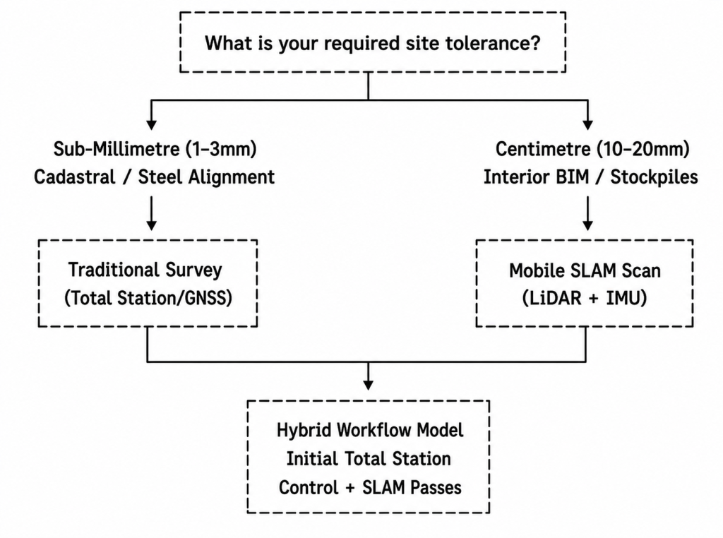
Technical Decision Framework: Choosing Your Measurement Method
Use this operational tolerance framework to determine the correct survey hardware for your project’s technical specifications:
Wrapping Up
Choosing between SLAM scanning and traditional surveying depends on your project’s required accuracy, timeline, and structural complexity. Hybrid approaches frequently deliver an optimal balance of speed and precision across modern construction environments.
Transform Your Project Efficiency with Us
Ready to optimise your construction survey workflow with cutting-edge 3D mobile spatial solutions? Contact us today to access industry-leading environmental and surveying expertise tailored specifically to your site’s unique structural demands.
Frequently Asked Questions
What is the Main Operational Difference Between SLAM and Traditional Surveying?
SLAM scanning captures continuous 3D spatial data while moving, whereas traditional surveying utilises static instruments to measure precise individual reference points from fixed positions.
Can SLAM Scanning Completely Replace Traditional Surveying Equipment on Construction Sites?
No, SLAM scanning cannot completely replace traditional surveying because high-precision tasks like legal boundary establishment and structural steel alignment still require millimetre-level optical precision.
What Level of Measurement Accuracy Can I Expect from SLAM Scanning?
Modern mobile SLAM scanners typically achieve relative accuracy between 10 and 20 millimetres, making them ideal for rapid interior mapping, floor plans, and BIM modelling.
How Does SLAM Scanning Improve Site Safety During Construction Surveys?
SLAM scanning allows technicians to capture complex, hazardous, or elevated areas rapidly from safe ground locations without deploying scaffolding or entering dangerous structural zones.
How Much Time Does SLAM Scanning Save Compared to Traditional Surveying?
SLAM scanning can capture complex spatial environments up to ten times faster than conventional methods, reducing field data collection from days to just hours.