
3D LiDAR capturing delivers millimetre-accurate spatial point clouds of heritage structures before demolition or restoration. It records intricate geometries, structural vulnerabilities, and architectural details to create permanent digital archives and actionable BIM models for modern engineering workflows.
Key Takeaways
- High-density laser scanning creates complete non-destructive digital archives preserving vulnerable historic architecture permanently.
- Millimetre-accurate spatial data enables seamless Scan-to-BIM modelling for complex restoration and structural engineering.
- Rapid documentation mitigates structural risk and regulatory compliance issues prior to controlled demolition activities.
Preserving historical integrity requires advanced spatial documentation tools capable of recording complex architectural details without causing physical harm. Traditional manual surveying methods often fall short when dealing with degraded structures, intricate facades, and inaccessible structural zones.
This blog explores how modern 3D LiDAR technology captures exact spatial point clouds to document heritage buildings, detailing its critical role during pre-demolition recording, structural restoration planning, and complex BIM modelling workflows.
Understanding 3D LiDAR Technology in Heritage Contexts
Light Detection and Ranging (LiDAR) uses rapid laser pulses to calculate precise physical distances to surrounding surfaces. In historic environments, these non-contact sensors emit millions of beams per second, capturing complex geometries without disturbing delicate materials or structural elements.
The resulting datasets form dense three-dimensional point clouds containing exact spatial coordinates for every scanned surface. These digital representations establish an immutable baseline record, preserving fine ornamental details, structural deviations, and material textures across internal and external building zones.
Here is how different LiDAR system applied in different heritage building 3D scanning contexts.
| LiDAR System Type | Deployment Method | Key Heritage Application | Typical Accuracy Range |
|---|---|---|---|
| Terrestrial Laser Scanning (TLS) | Stationary Tripod Mounts | High-detail facades, ornate interiors, and historic masonry. |
1mm – 5mm |
|
Mobile SLAM Systems |
Wearable or Handheld Scanners | Complex corridors, multi-room layouts, and tight spaces. | 5mm – 15mm |
| Aerial LiDAR Drones | Unmanned Aerial Vehicles (UAVs) | Roof structures, tall spires, and expansive site topography. |
10mm – 30mm |
Table 1: Variation of LiDAR Systems Used in Pre-demolition Recording of Heritage Buildings
High-Density Point Cloud Generation
Point cloud collection forms the foundational layer of digital heritage documentation. Specialised sensors fire continuous laser arrays while integrated high-resolution cameras simultaneously capture true-colour RGB values for every individual coordinate point.
This process registers millions of spatial references into a unified coordinate system. The resulting coloured point cloud offers immersive visual clarity alongside rigorous geometric precision, allowing engineers to inspect structural conditions remotely.
Mobile SLAM vs. Terrestrial Scanning
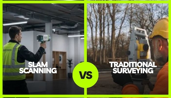
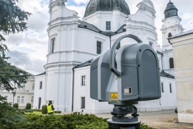
Terrestrial systems provide sub-millimetre precision from fixed tripod locations, making them ideal for detailed structural analysis. However, mobile Simultaneous Localisation and Mapping (SLAM) devices offer unmatched speed through complex interiors.
Integrating both approaches ensures complete spatial coverage across expansive heritage properties. SLAM rapidly maps interior circulation paths, while stationary terrestrial units capture high-precision data on critical load-bearing walls and decorative elements.
Learn more about the difference between SLAM Scanning vs. Traditional Surveying here.
Pre-Demolition Documentation and Archival Compliance
When historical structures face partial or total removal due to severe degradation or site redevelopment, comprehensive spatial documentation becomes a strict regulatory requirement. LiDAR provides an undeniable record of original construction methods.
3D scanning for heritage preservation eliminates spatial ambiguities during archival recording workflows. By capturing every architectural feature before site intervention, project teams fulfil statutory preservation mandates while retaining accurate historical records for future academic and civic research.
This table shows different phases of project documentation where LiDAR can provide accurate outputs.
| Archival Document Phase | Primary Technical Output | Project Purpose & Benefit |
|---|---|---|
| Initial Conditions Capture | Raw Point Clouds & Panoramic Imagery |
Establishes an immutable legal baseline before any site activity. |
|
As-Built CAD Drafting |
2D Elevations, Floor Plans & Sections | Provides precise dimensional drawings for regulatory authority approval. |
| BIM Lifecycle Archiving | Parametric 3D Scan-to-BIM Models |
Retains fully navigable digital twins for historical and structural reference. |
Table 2: Documentation in Different Project Phases
Risk Mitigation During Structural Deconstruction
Demolishing adjacent modern structures poses severe vibration risks to frail historic walls. Baseline laser scans map pre-existing cracks, out-of-plumb masonry, and structural deformations with extreme precision before work commences.
Subsequent scanning passes during construction allow engineers to detect micro-movements early. This proactive spatial monitoring protects surrounding heritage fabric, reduces contractor liability, and maintains site safety throughout active deconstruction phases.
Laser Scanning for Restoration and Conservation
Restoration projects require absolute dimensional accuracy to ensure new structural components integrate seamlessly with historic building fabric.
By capturing millimetre-accurate spatial data across complex historical geometries, laser scanning provides the essential, error-free point cloud foundation required to construct precise parametric Scan-to-BIM models.
Scan-to-BIM Workflows in Historic Preservation
Raw point cloud data transitions into intelligent building information models through specialised Scan-to-BIM workflows. Engineers convert unstructured laser points into parametric elements within software environments like Autodesk Revit.
These BIM models allow multidisciplinary design teams to coordinate structural repairs without spatial guesswork. Architects overlay proposed mechanical, electrical, and plumbing interventions directly against historic geometries to prevent unintended damage to original building fabric.
Key benefits of the specialised Scan-to-BIM technologies include:
- Precise conversion of spatial point clouds into native Revit elements.
- Automated clash detection between new utilities and historic framing.
- Deformation analysis showing structural sagging and wall tilt vectors.
- Detailed quantity take-offs for accurate conservation material budgeting.
- Enhanced collaboration across heritage consultants, engineers, and builders.
At SERS, our expert surveyors make the best use of NavVis VLX3, a mobile mapping system with state-of-the-art technological implementation, revolutionising the way of conducting different dilapidation surveys.
Non-Destructive Structural Health Assessment
Historic materials like aged timber, lime mortar, and soft stone deteriorate under direct physical stress. Laser sensors measure structural integrity entirely from a distance, eliminating the need for invasive physical probing or disruptive temporary scaffolding.
Repeated laser passes highlight active structural movement over time. By comparing sequential datasets, structural engineers identify settling foundations, expanding cracks, and load-bearing failures well before catastrophic structural collapse occurs.
Integrating Aerial LiDAR and Topographic Surveys
Documenting heritage sites extends beyond primary exterior walls. Comprehensive preservation requires capturing surrounding terrain, retaining walls, roof geometry, and outbuildings to understand the complete environmental context of the historical asset.
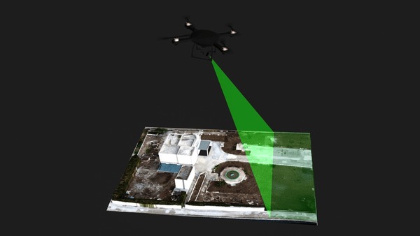
Combining ground-based scanners with aerial LiDAR scanners creates unified spatial datasets. Drones used in aerial LiDAR surveys map upper roof structures and inaccessible chimneys, while terrestrial units record ground-level architectural features, producing an accurate 3D model of the site.
Roof and High-Access Structure Capture
Inspecting historic roofs manually presents extreme safety hazards and risks breaking fragile slate or terracotta tiles. Drones equipped with LiDAR sensors fly above complex roofscapes, firing laser pulses through tree canopies to record hidden structural elements.
This aerial data seamlessly merges with terrestrial interior scans. The combined dataset gives architects a complete digital cross-section of the building, ensuring every truss, chimney, and dormer is perfectly documented for repair operations.
Site Topography and Landscape Context
Surrounding ground contours directly impact heritage building stability through stormwater runoff and soil movement. LiDAR topographic surveys map ground surfaces around historic foundations, identifying potential drainage issues before water damages original masonry.
Here is how site topography can be properly understood through 3D scans:
- Accurate mapping of complex site elevations and drainage paths.
- Seamless integration of aerial spatial data with interior floor plans.
- Non-contact inspection of crumbling high-level stonework and spires.
- Precise volumetric calculations for surrounding soil and excavation works.
- Reliable spatial baselines for long-term environmental monitoring programs.
Wrapping Up
Deploying 3D LiDAR scanning provides essential spatial accuracy, preserving delicate heritage structures through digital twin creation, detailed Scan-to-BIM modelling, and non-destructive structural documentation. These point cloud datasets safeguard historical assets before critical restoration or demolition activities.
Partner with Us for Expert Survey Before Restoring or Demolishing a Heritage Building!
Ready to safeguard your historic property with advanced spatial documentation? Contact us at SERS for industry-leading 3D scanning, dilapidation reporting, and environmental consultancy services tailored to protect your high-value assets across Australia.
Frequently Asked Questions
How Does 3D Laser Scanning Protect Delicate Heritage Building Materials During a Site Survey?
3D laser scanning for heritage building projects is completely non-contact and non-destructive. Sensors capture detailed structural data from a distance, eliminating the need for physical contact, scaffolding, or invasive measuring tools that could crumble fragile masonry.
What Spatial Deliverables are Generated from A Heritage Building LiDAR Survey?
Surveys produce high-density 3D point clouds, colourised mesh models, 2D CAD floor plans, structural elevation drawings, and parametric Revit BIM models for restoration planning and legal archival compliance.
Why is Aerial LiDAR Necessary Alongside Ground-Based Laser Scanning for Historic Sites?
Aerial LiDAR captures inaccessible rooflines, high spires, and broad site topography that ground scanners cannot reach. Merging aerial and ground datasets creates a complete, gap-free digital model of the property.
Can 3D Laser Scans Detect Structural Movements or Bowing Walls in Aged Buildings?
Yes, laser scans capture millimetre-accurate surface geometries. Comparing scan point clouds against true vertical planes instantly highlights wall leans, sagging ceiling joists, and foundation settlement throughout the structure.
How Long Does It Take to Complete A 3D LiDAR Survey of a Typical Historic Property?
Using advanced mobile SLAM and terrestrial scanning tools, field technicians can document large historic structures in a single day, drastically reducing site disruption compared to manual surveying methods.